Großer Feldberg — towers and transmitters in 3D.
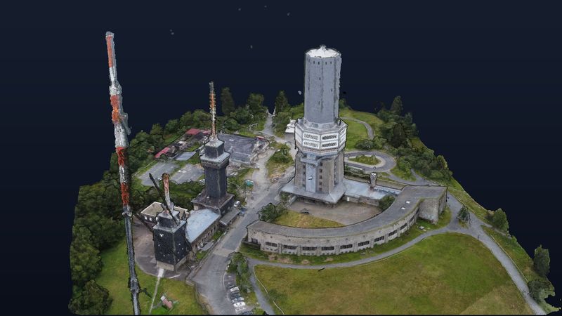
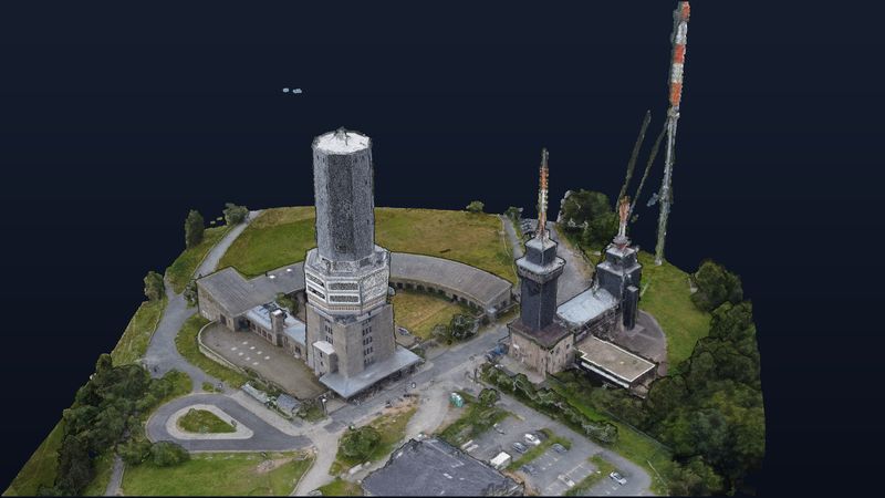
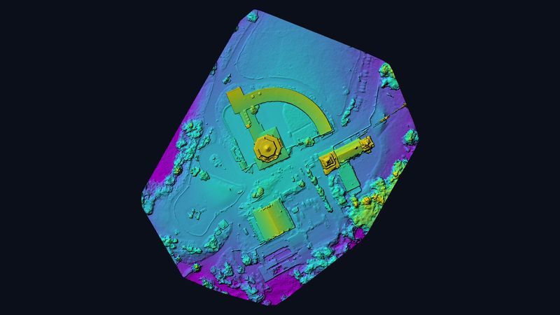
On the highest summit of the Taunus hills, the telecommunication tower, transmitter mast and observation tower stand close together. In 20 minutes of flight time we captured the summit plateau with 127 images — the 3D model shows every structure true to scale and free to rotate.
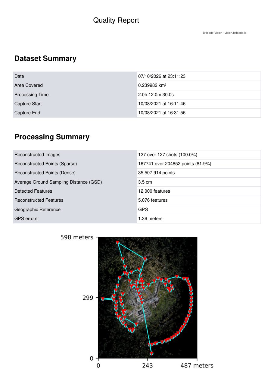
Figures from the photogrammetry quality report.
Rotate, zoom and measure it yourself.
Controls: left mouse button rotates, scroll wheel zooms, right mouse button pans. The menu on the left has measuring tools for distances, areas and heights.
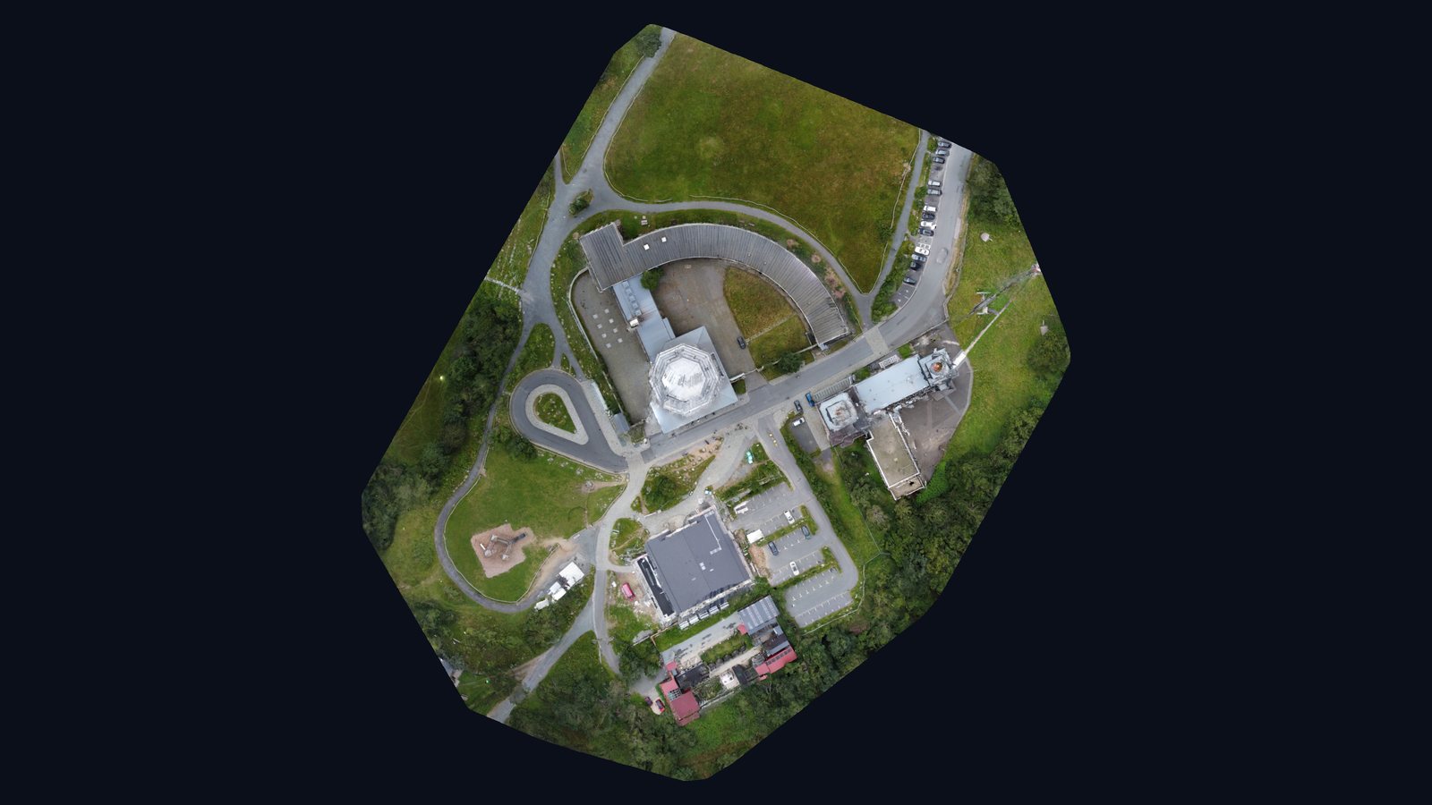
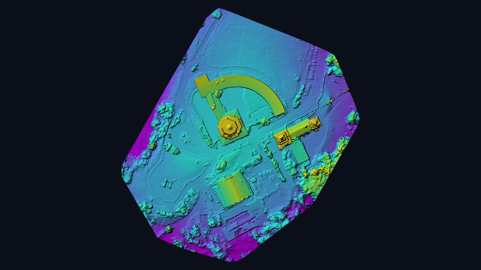
The transmitter site above the Rhine-Main region.
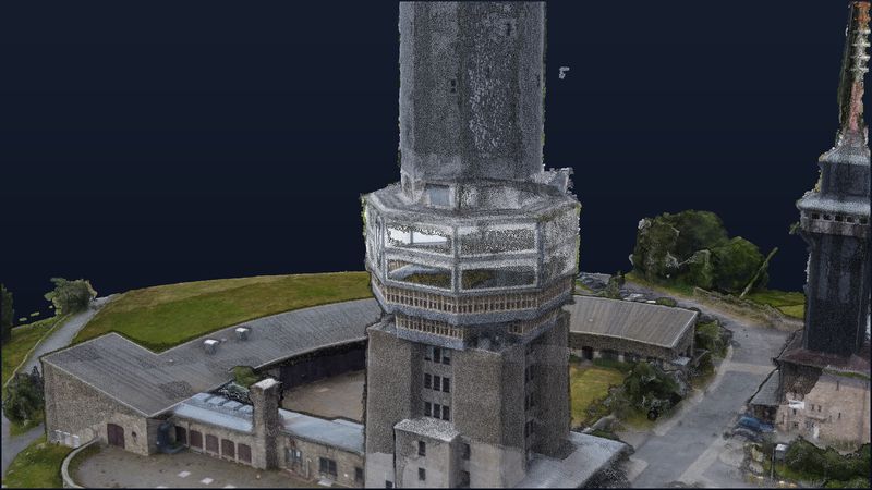
The Großer Feldberg near Schmitten, at about 880 m, is the highest mountain of the Taunus near Frankfurt. On its summit stands the telecommunication tower, begun in 1937; a concrete base carries a shaft that today reaches about 69 m. In 1943 the tower burned out after an aircraft struck it in fog and was rebuilt after the war. Since 1949 the broadcaster Hessischer Rundfunk has also transmitted from its own site on the summit. The tower serves FM broadcasting, radio relay and amateur radio and is not open to the public.
Tall structures, compact plateau.
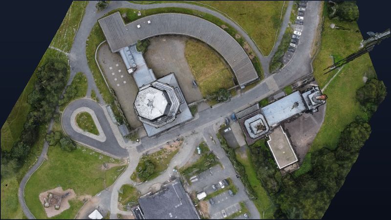
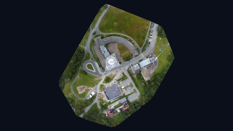
The flight on 10 August 2021 took about 20 minutes. All 127 images were reconstructed; the model covers 0.24 km² at about 3.5 cm ground resolution and fully represents towers, mast, buildings and access roads.
Digital as-built data for transmitter sites.
For operators of radio and transmitter sites such a model is the basis for planning and maintenance: heights, distances and attachments can be measured on screen, conversions visualised in advance and site visits prepared precisely.
Sources on the site: Wikipedia (de): Fernmeldeturm Großer Feldberg · Wikipedia: Großer Feldberg
Views from the model.
Request a similar project
Describe your project briefly — we respond within one business day with method, output and a concrete quote.